
Hi guys
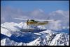
In the next week or so we might have to take a navajo from red deer to california, therefore crossing the rockies VFR and both of us have close to none experience in mountain flying. Do you veterans of the rockies have somes hints and tips so we can make our way safely to calif?
Thanks
Gig
Crossing the Rockies, VFR
Moderators: sky's the limit, sepia, Sulako, lilfssister, North Shore, I WAS Birddog
-
tailgunner
- Rank 7

- Posts: 501
- Joined: Mon May 17, 2004 4:03 pm

Hope this helps.
Red Deer to Boise Idaho (customs there). about 550nm. 12000 will get you over all the rock direct (from Calgary).
Boise to California also at 12,000 if you are going to Socal. North Cal may be different.
If you go farther west there is a big valley running north south. I never have tried it but many apparently have.
Just a little notice. Wx. is usually not that good on the northern part of the trip, so if you dont have anti ice/de ice capabilities be very careful.
Also, as you cross border they will switch you to US (great falls if i remember correctly). If you use Canadian XXXX and ask for flight following they will give you a squawk code and keep you on radar for the whole trip even when you are VFR.
Have fun. Hope this helps.
-
200hr Wonder
- Rank 10

- Posts: 2212
- Joined: Tue Apr 26, 2005 1:52 pm
- Location: CYVR
- Contact:
I have crossed the rocks only a few times in a 172. Here are a few hints:
Be aware of sudden weather changes, espcially in winter. CHeck for a Chinooks coming out of Calgary, if they are stay out of the bumpy bits cause it can get ugly.
Carry some survival gear just in case, and warm clothes as well as a good warm sleeping bag.
I would highly recemend if you can do it go find an old hand who has flown in the rocks and get a good briefing on mountain flying techiques. You really need to know what to look for for things like Mountain Waves, updrafts, down drafts and all that. I certainly do not have hte hours to brief that, having only done it a few times.
Remeber... fly on the sunny side.
Cheers!
bumpy bits
Just exactly how do you stay out of the bumpy bits. I have crossed the rocks 3 or 4 times a week for the past three years. If it was that easy, why didn't someone tell me earlier. Yes he rocks have their challenges but i have had great rides across in Chinooks, mountain wave activity, and horrible rides in "OK" conditions. I personally think a good ride across is a matter of luck. Yes, in windy conditions, there is a very good chance of a rough ride, but not always. If you are in a HO, i doubt you will be flying down in the valley's so the sunny side thing probably will not apply. But is you are going VFR at 12500, just find a nice clear day and go. You may get some bumps, but you will also have a hell of a great time looking at the scenery.
-
200hr Wonder
- Rank 10
- Posts: 2212
- Joined: Tue Apr 26, 2005 1:52 pm
- Location: CYVR
- Contact:
")
http://www.avcanada.ca/forums2/viewtopi ... ht=#114981
Your routing is different. I'd suggest 12500' VFROTT on a nice high pressure day. Fuel/customs/lunch break in Boise (customs availability can be unreliable here) and then off to destination.
Good luck
Your routing is different. I'd suggest 12500' VFROTT on a nice high pressure day. Fuel/customs/lunch break in Boise (customs availability can be unreliable here) and then off to destination.
Good luck
Aviation- the hardest way possible to make an easy living!
"You can bomb the world to pieces, but you can't bomb it into peace!" Michael Franti- Spearhead
"Trust everyone, but cut the cards". My Grandma.
"You can bomb the world to pieces, but you can't bomb it into peace!" Michael Franti- Spearhead
"Trust everyone, but cut the cards". My Grandma.

few things I had to consider and reconsider
I only crossed the rockies 3 times for ferry flight since last year but, make sure that:
-(trivial) weather looks not ok but great.
-if you can go over, then go on top...
-study carefully your planned route with alternates (there is plenty for vfr on wheels), I had to do it on wheels and on floats twice.
-Never never underestimate the weather. if it s 10 knopts on a flat surface, it might be 20 knots or more in the mountains.
-weather changes are superfast.
-if you ever plan to go low level, you might want study a little bit about mountain flying, updrafts ,downdraft etc... work with the weather, not against. he is stronger than you.
-as you go through, record some landmarks in your gps, just in case you get lost, you will be able to backtrack and start over. (watch your fuel though)
-plan your route with overestimating the distance. Some time the winds are so strong than your GS sucks.
-stay on the updraft side of the valley or sunny side, whichever is better.
-monitor your fuel carefully.
-make some report to FSS once in a while. you might not be able to get anybody but you can get relayed by somebody else flyingn above you.
-when you want to climb, don t force it but use the good sides of the mountains.
-if you have to perform a tight turn in a tight valley, slow down, flaps down, bank it and wath your speed.
DON T FORGET THAT IN A MOUNTAINS CIRCUS YOU LOOSE YOUR HORIZON REFERENCE...
-ALWAYS DOUBLE CHECK BOTH WAYS GPS AND MAP. DON T LET GO ONE OF THEM.
WELL THERE ARE SO MANY THINGS TO THINK ABOUT...
DO IT SAFELY, WISELY AND IF YOU DON T FEEL LIKE GOING THAT DAY, JUST DON T...
BETTER SAFE THAN SORRY AND NOBODY WILL ARGUE WITH YOU FOR SAFETY ISSUE.
I flew 3 different routes so far. but from red deer, if you plan the lower route, you could try via abrahams lake but it s a bit north. Or go through banff, lake louise, rogers path(very tight at low alt) golden, kamloops, merrit, hope and vancouver.
but there is probably a better route straight down south on your way...
-and one more thing, it might sound trivial for some but i have seen guys not doing it in mountains. You want to hold your map in the same direction as you go and where you look at because navigation landmarks can get really hard to get in mountains and vis could be low and valleys look alike sometime...
BECAREFULL AND GOOD LUCK
Years ago i used to do CYQL- Ely Nevada- Visalia Calif. in a non turbo,non de-iced Cessna 337 and I found the best route was fron CYQL to Helena Mont. , across the Manida Pass to Dubois IDA. and Pokatello to Salt Lake and across the desert to Ely Nevada and over the Serria Nevada mountains to the California coast. Most of Utah, Nevada is desert and very dry. !2,500 VFR is good. Toughest part wx wise is getting over the Serria Nevada mountains.
The average pilot, despite the somewhat swaggering exterior, is very much capable of such feelings as love, affection, intimacy and caring.
These feelings just don't involve anyone else.
These feelings just don't involve anyone else.

vfr route
I have done the trip many times cookinglake / Edmonton to LA via Vegas. VFR is ussually no problem around Idaho falls south through Salt Lake and LasVegas. Customs in Cutbank is great, guy there never gives you any problmes and fuel is cheap, after that go Idaho falls for next cheap gas and then Milford after that you can probably go direct. Great VFR route along that track its pretty easy to spot. If you got any questions you can call me at work 780-922-2802 out at cooking lake aviation. Names Barret
Gig
Some tips:
1. Get a good weather brief from an FSS specialist familiar with your chosen route. Have the VFR charts with you and go over your route with him/her and they should be able to tell you what to expect from the Area Forecasts.
2. If it's windy and you don't much like turbulence, put it off until another day. That's not to say you can't fly through the rocks when it's windy, people do it every day.
3. When the ceiling comes down, beautiful mountain valleys become tunnels. The lower the ceiling the smaller the tunnel. That's not bad either unless the tunnel gets too small and you don't have enough room to turn around.
4. Always leave yourself an escape route or a way out of somewhere. Don't stick your nose into a valley unless you are certain you can either go all the way through or turn around.
5. In the winter, if the ceiling is uniform with little or no precipitation around life is good. If it's ragged and there are snow squalls, be very suspicious because the route you just flew through without any problem may be blocked if you try and turn around. If there is a good chance of precipitation on your route, find another route or stay where you are until things improve.
6. Always keep in mind that the mountains are much bigger than you are and won't get out of your way. You have to go around, through or over them.
7. Enjoy the scenery.
